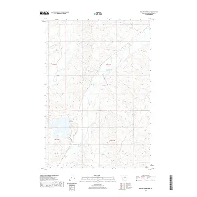
2020 Map of Willow Creek Dam
USGS Topo · Published 2020About this map
Willow Creek Dam controls the flow of its namesake waterway in this section of Big Horn County, Montana, anchoring an extensive network of 21st-century irrigation infrastructure. The landscape is defined by the management of water across the high plains, evidenced by the Lodge Grass Canal Number Two, the Lodge Grass Feeder Canal, and family-named water projects such as the Robert Miller Ditch and William Miller Ditch.
Find a feature on this map
21 named features on this map. Tap any name to fly to it.
Don’t see what you’re looking for? This feature index may not catch every label — zoom into the map to look around manually.
Map Details
Editions of this 2020 Willow Creek Dam Map
This is the sole edition of this map. No revisions or reprints were ever made.
Other maps of this area

1894 · Rosebud
USGS Topo · 1:125,000

1894 · St. Xavier
USGS Topo · 1:125,000

1901 · Rosebud
USGS Topo · 1:125,000

1901 · St. Xavier
USGS Topo · 1:125,000

1954 · Hardin
USGS Topo · 1:250,000

1957 · Hardin
USGS Topo · 1:250,000

1958 · Hardin
USGS Topo · 1:250,000

1960 · Schick Ranch
USGS Topo · 1:24,000

1960 · Mission Coulee
USGS Topo · 1:24,000
1967 · Wyola
USGS Topo · 1:24,000