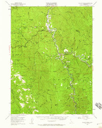
1952 Map of Willow Creek
USGS Topo · Published 1959About this map
The Trinity River and its South Fork dominate this 1950s terrain, where the river valley serves as the primary corridor for settlement and transit. In the northern reaches, the Hoopa Valley Indian Res borders a landscape defined by sharp ridges like Indian Field Ridge and Panther Ridge. Small clusters of activity are found at Willow Creek and China Flat, while the higher elevations are marked by seasonal outposts and industrial sites including Friday Camp and the Horse Mtn Mine.
Find a feature on this map
90 named features on this map. Tap any name to fly to it.
Don’t see what you’re looking for? This feature index may not catch every label — zoom into the map to look around manually.
Map Details
Editions of this 1952 Willow Creek Map
4 editions found

Other maps of this area

1909 · Big Bar
USGS Topo · 1:96,000

1914 · Pilot Creek
USGS Topo · 1:62,500

1915 · Big Bar and Vicinity
USGS Topo · 1:250,000

1922 · Korbel
USGS Topo · 1:62,500

1922 · China Flat
USGS Topo · 1:62,500

1922 · Kneeland
USGS Topo · 1:62,500

1925 · Hoopa
USGS Topo · 1:125,000

1945 · Coyote Peak
USGS Topo · 1:62,500

1945 · Blue Lake
USGS Topo · 1:62,500

1948 · Weed
USGS Topo · 1:250,000