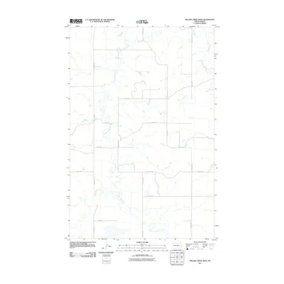
2011 Map of Willow Creek West
USGS Topo · Published 2011About this map
The Knife River and its meandering tributary, the Branch Knife River, define the hydrology of this Stark County landscape. This 2011 survey reveals a classic section-line road grid typical of the Great Plains, where gravel roads like 82nd Ave SW and 80th Ave SW facilitate access across the open terrain. The drainage of Willow Creek enters from the east, carving through the prairie to join the primary river systems. This map is particularly useful for researchers studying the modern agricultural layout and the precise network of rural routes, including specific alignments such as 23rd St SW and 28 1/2 St SW, which illustrate the enduring influence of the Public Land Survey System on local transportation and property boundaries.
Find a feature on this map
14 named features on this map. Tap any name to fly to it.
Don’t see what you’re looking for? This feature index may not catch every label — zoom into the map to look around manually.
Map Details
Editions of this 2011 Willow Creek West Map
This is the sole edition of this map. No revisions or reprints were ever made.
Other maps of this area

1953 · Dickinson
USGS Topo · 1:250,000

1953 · Watford City
USGS Topo · 1:250,000

1957 · Dickinson
USGS Topo · 1:250,000

1957 · Watford City
USGS Topo · 1:250,000

1967 · Watford City
USGS Topo · 1:250,000

1973 · Marshall SE
USGS Topo · 1:24,000
1973 · Hebron
USGS Topo · 1:24,000

1973 · Schaffner Creek NE
USGS Topo · 1:24,000

1973 · Willow Creek West
USGS Topo · 1:24,000

1973 · Schaffner Creek
USGS Topo · 1:24,000