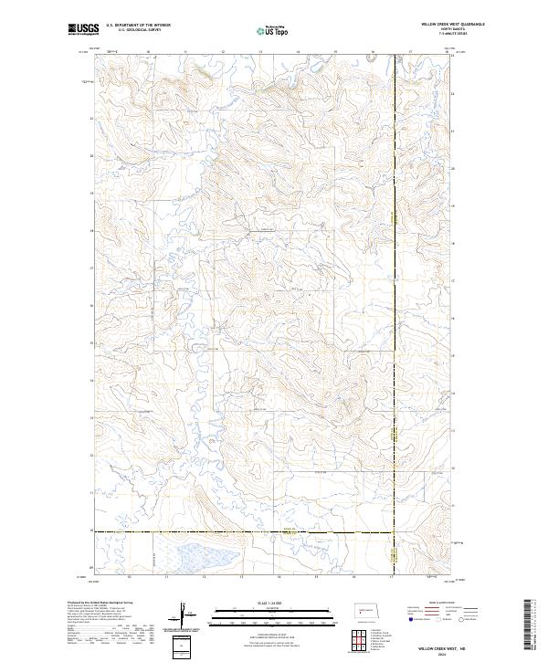
2024 Map of Willow Creek West
USGS Topo · Published 2024About this map
The Knife River and its intricate tributaries dominate this section of the North Dakota plains, where the Branch Knife River carves a winding path through the rolling landscape. This area, situated at the intersection of Dunn, Mercer, and Stark counties, reflects the enduring grid of the Public Land Survey System. The map documents the rural infrastructure of the early 21st century, defined by a network of section-line roads like 82nd Ave SW and east-west thoroughfares including 21st St SW and 27th St SW. To the northeast, Willow Creek drains toward the main river valley. This is a landscape of vast agricultural tracts and intermittent wetlands, where modern county roads like Co Rd 3 provide the primary access to the remote upland divides between the river branches.
Find a feature on this map
18 named features on this map. Tap any name to fly to it.
Don’t see what you’re looking for? This feature index may not catch every label — zoom into the map to look around manually.
Map Details
Editions of this 2024 Willow Creek West Map
This is the sole edition of this map. No revisions or reprints were ever made.
Other maps of this area

1953 · Dickinson
USGS Topo · 1:250,000

1953 · Watford City
USGS Topo · 1:250,000

1957 · Dickinson
USGS Topo · 1:250,000

1957 · Watford City
USGS Topo · 1:250,000

1967 · Watford City
USGS Topo · 1:250,000

1973 · Marshall SE
USGS Topo · 1:24,000
1973 · Hebron
USGS Topo · 1:24,000

1973 · Schaffner Creek NE
USGS Topo · 1:24,000

1973 · Willow Creek West
USGS Topo · 1:24,000

1973 · Schaffner Creek
USGS Topo · 1:24,000