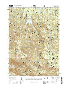
2014 Map of Willow Lake
USGS Topo · Published 2014About this map
Willow Lake serves as a central hydrological feature within this section of the Rogue River National Forest during the early 21st century. The landscape is defined by its complex network of named drainages and meadows, including Parker Meadow in the north and the expansive Willow Prairie to the southeast. These natural openings and water sources, such as Shake Camp Spring and Porcupine Spring, hint at the area's long history of seasonal use and resource management. Elevation is marked by several prominent summits including Bieberstedt Butte and Esmond Mtn. The transport network relies heavily on forest access roads like Butte Falls-Fish Lake Rd and Trefren Mill Rd, connecting remote sites like Indian Glade to the primary Lake of the Woods Hwy in the south.
Find a feature on this map
64 named features on this map. Tap any name to fly to it.
Don’t see what you’re looking for? This feature index may not catch every label — zoom into the map to look around manually.
Map Details
Editions of this 2014 Willow Lake Map
This is the sole edition of this map. No revisions or reprints were ever made.
Other maps of this area

1891 · Ashland
USGS Topo · 1:250,000

1893 · Ashland
USGS Topo · 1:250,000

1897 · Ashland
USGS Topo · 1:250,000

1938 · Medford
USGS Topo · 1:125,000

1954 · Butte Falls
USGS Topo · 1:62,500

1954 · Lakecreek
USGS Topo · 1:62,500

1955 · Rustler Peak
USGS Topo · 1:62,500

1955 · Mt. Mc Loughlin
USGS Topo · 1:62,500

1955 · Medford
USGS Topo · 1:250,000

1957 · Medford
USGS Topo · 1:250,000