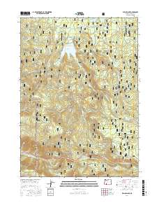
2017 Map of Willow Lake
USGS Topo · Published 2017About this map
Willow Lake serves as a central hydrological feature within the Rogue River National Forest in Jackson County, showing a landscape defined by forest management and drainage systems. This 2017 survey details a network of timber roads like Butte Falls-Fish Lake Rd and Trefren Mill Rd that navigate the high-elevation terrain. Named landmarks such as Bieberstedt Butte and Esmond Mtn provide vertical relief, while the presence of Swamp Cr Reservoir and numerous springs like Shake Camp Spring and Whiskey Spring emphasize the importance of water resources in the Cascades. Local naming conventions are evident in features like Indian Glade and Willow Prairie, offering researchers a look at how this mountain environment was segmented and identified by the Forest Service and early settlers.
Find a feature on this map
63 named features on this map. Tap any name to fly to it.
Don’t see what you’re looking for? This feature index may not catch every label — zoom into the map to look around manually.
Map Details
Editions of this 2017 Willow Lake Map
This is the sole edition of this map. No revisions or reprints were ever made.
Other maps of this area

1891 · Ashland
USGS Topo · 1:250,000

1893 · Ashland
USGS Topo · 1:250,000

1897 · Ashland
USGS Topo · 1:250,000

1938 · Medford
USGS Topo · 1:125,000

1954 · Butte Falls
USGS Topo · 1:62,500

1954 · Lakecreek
USGS Topo · 1:62,500

1955 · Rustler Peak
USGS Topo · 1:62,500

1955 · Mt. Mc Loughlin
USGS Topo · 1:62,500

1955 · Medford
USGS Topo · 1:250,000

1957 · Medford
USGS Topo · 1:250,000