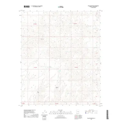
2018 Map of Willow Mountain
USGS Topo · Published 2018About this map
Willow Mtn dominates this high-altitude corner of Graham County, where the landscape is defined by its seasonal water sources and deep drainage systems. The presence of numerous named catchments, such as Packsaddle Tank and the uniquely titled Windy Bob Tank, underscores the importance of water management in this arid ranching or wildlife territory. This 2018 survey reveals a terrain carved by substantial canyons, including Bull Canyon and Windy Bob Canyon. These drainages feed into systems like Middle Prong Cr and Wet Prong Cr, which dictate the movement of both animals and those managing the land. The mapping of Jimmy Land Tank further suggests the legacy of individual land-users or families who established infrastructure in this remote part of Arizona, providing essential data for genealogists and land historians tracing historical usage rights or local landmarks.
Find a feature on this map
15 named features on this map. Tap any name to fly to it.
Don’t see what you’re looking for? This feature index may not catch every label — zoom into the map to look around manually.
Map Details
Editions of this 2018 Willow Mountain Map
This is the sole edition of this map. No revisions or reprints were ever made.
Other maps of this area

1913 · Morenci
USGS Topo · 1:125,000

1915 · Morenci
USGS Topo · 1:125,000

1922 · Nutrioso
USGS Topo · 1:125,000

1954 · Clifton
USGS Topo · 1:250,000

1957 · Clifton
USGS Topo · 1:250,000

1958 · Clifton
USGS Topo · 1:250,000

1958 · Hannagan Meadow
USGS Topo · 1:62,500

1962 · Clifton
USGS Topo · 1:250,000

1967 · Freezeout Mountain
USGS Topo · 1:24,000

1967 · Robinson Mesa
USGS Topo · 1:24,000