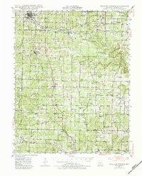
1945 Map of Willow Springs
USGS Topo · Published 1984About this map
Willow Springs serves as the primary rail hub on this mid-century survey, where the St Louis San Francisco railroad cuts through the Ozark landscape. The rail corridor tethers a line of smaller communities including Burnham, Pomona, and Olden, each surrounded by a network of rural schools and family-centered landmarks such as Burnham Cem and Walkers Chapel. To the northeast, the village of Trask sits near the headwaters of the Eleven Point River, while the southern reaches are marked by the presence of Sky Haven Airport and the winding Galloway Creek. The map reveal a pattern of upland farming and remote timber country, characterized by numerous local gathering points like Dripping Springs Ch and Lone Pine Sch that served the dispersed homesteads of Hutton Valley and Spring Creek townships.
Find a feature on this map
55 named features on this map. Tap any name to fly to it.
Don’t see what you’re looking for? This feature index may not catch every label — zoom into the map to look around manually.
Map Details
Editions of this 1945 Willow Springs Map
3 editions found
Other maps of this area

1938 · West Plains
USGS Topo · 1:24,000

1939 · Topaz
USGS Topo · 1:62,500

1940 · West Plains
USGS Topo · 1:24,000

1941 · Topaz
USGS Topo · 1:62,500

1943 · Thayer
USGS Topo · 1:62,500

1944 · West Plains
USGS Topo · 1:62,500

1944 · Cureall
USGS Topo · 1:62,500

1945 · Harrison
USGS Topo · 1:250,000

1945 · Willow Springs
USGS Topo · 1:62,500

1945 · Montier
USGS Topo · 1:62,500