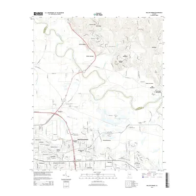
2014 Map of Willow Springs
USGS Topo · Published 2014About this map
The Tallapoosa River carves a winding path through this central Alabama landscape, serving as the boundary between Elmore and Montgomery counties. In the northern reaches, the terrain rises toward Jasmine Hill and Blue Ridge, where residential expansion meets old rural landmarks like Haggerty Cem. The southern half of the map is dominated by the northeastern outskirts of Montgomery, featuring a dense network of neighborhoods such as Dalraida, Eastmont, and Mitylene. Local educational institutions, including Faulkner Univ and Virginia College-Montgomery, anchor the suburban development along the Atlanta Hwy. Numerous small cemeteries, such as Old Bingham Cem and Goodhope Cem, are scattered throughout, providing critical touchpoints for genealogists researching family history in the Redland and Emerald Mountain areas.
Find a feature on this map
53 named features on this map. Tap any name to fly to it.
Don’t see what you’re looking for? This feature index may not catch every label — zoom into the map to look around manually.
Map Details
Editions of this 2014 Willow Springs Map
This is the sole edition of this map. No revisions or reprints were ever made.
Other maps of this area

1901 · Wetumpka
USGS Topo · 1:125,000

1901 · Wetumpka
USGS Topo · 1:62,500

1903 · Wetumpka
USGS Topo · 1:125,000

1927 · Montgomery
USGS Topo · 1:48,000

1930 · Montgomery
USGS Topo · 1:62,500

1953 · Montgomery
USGS Topo · 1:250,000

1956 · Montgomery
USGS Topo · 1:250,000

1957 · Montgomery
USGS Topo · 1:250,000

1958 · Montgomery
USGS Topo · 1:62,500

1958 · Montgomery North
USGS Topo · 1:24,000