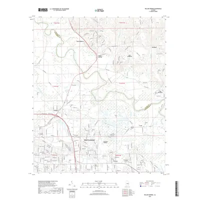
2018 Map of Willow Springs
USGS Topo · Published 2018About this map
The Tallapoosa River defines the physical and political landscape of this region, acting as the winding boundary between Elmore and Montgomery counties. To the north, settlements like Wetumpka, Willow Springs, and Redland sit amidst a network of rural routes including Jasmine Hill Rd and Covered Bridge Rd. The area is notably dense with family and community burial sites, from the Haggerty Cem in the north to the Old Bingham Cem near the eastern edge.
Find a feature on this map
180 named features on this map. Tap any name to fly to it.
Don’t see what you’re looking for? This feature index may not catch every label — zoom into the map to look around manually.
Map Details
Editions of this 2018 Willow Springs Map
This is the sole edition of this map. No revisions or reprints were ever made.
Other maps of this area

1901 · Wetumpka
USGS Topo · 1:125,000

1901 · Wetumpka
USGS Topo · 1:62,500

1903 · Wetumpka
USGS Topo · 1:125,000

1927 · Montgomery
USGS Topo · 1:48,000

1930 · Montgomery
USGS Topo · 1:62,500

1953 · Montgomery
USGS Topo · 1:250,000

1956 · Montgomery
USGS Topo · 1:250,000

1957 · Montgomery
USGS Topo · 1:250,000

1958 · Montgomery
USGS Topo · 1:62,500

1958 · Montgomery North
USGS Topo · 1:24,000