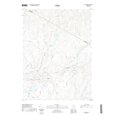
2019 Map of Willowemoc
USGS Topo · Published 2019About this map
Willowemoc Creek and its many tributaries carve through the mountainous terrain at the border of Ulster and Sullivan counties. This part of the Catskills is defined by high peaks like Mongaup Mtn and Slawson Mtn, interspersed with a high density of glacial ponds and hollows. Small settlements including Willowemoc, Debruce, and Anderson are clustered along the valley floors, connected by a network of winding mountain roads like Brown Settlement Rd and Flugertown Rd. The landscape is a mix of protected wild lands and private holdings, indicated by the presence of a Camp Ground near Hunter Pond and numerous named water bodies such as Mongaup Pond, Hodge Pond, and Frick Pond. The drainage patterns, including the Beaver Kill and Little Beaver Kill, illustrate the region's historical importance for freshwater ecosystems and watershed management.
Find a feature on this map
67 named features on this map. Tap any name to fly to it.
Don’t see what you’re looking for? This feature index may not catch every label — zoom into the map to look around manually.
Map Details
Editions of this 2019 Willowemoc Map
This is the sole edition of this map. No revisions or reprints were ever made.
Other maps of this area

1901 · Margaretville
USGS Topo · 1:62,500

1904 · Margaretville
USGS Topo · 1:62,500

1910 · Neversink
USGS Topo · 1:62,500

1921 · Livingston Manor
USGS Topo · 1:62,500

1922 · Andes
USGS Topo · 1:62,500

1923 · Livingston Manor
USGS Topo · 1:62,500

1924 · Andes
USGS Topo · 1:62,500

1942 · Neversink
USGS Topo · 1:62,500

1943 · Monticello
USGS Topo · 1:125,000

1944 · Livingston Manor
USGS Topo · 1:62,500