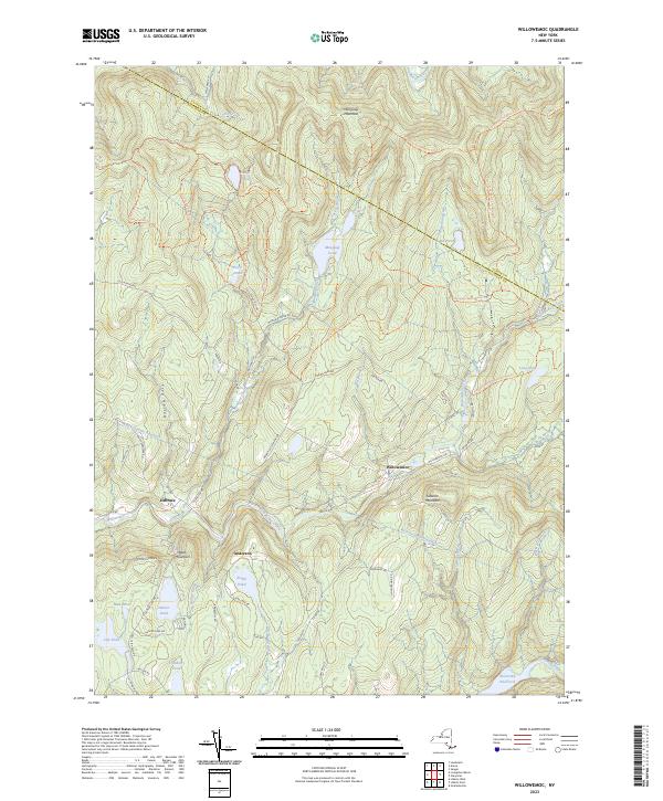
2023 Map of Willowemoc
USGS Topo · Published 2023About this map
Willowemoc Creek and its many tributaries, including Shin Creek, Fall Brook, and Butternut Brook, dominate this landscape at the border of Ulster and Sullivan counties. The settlement pattern is defined by small clusters like Debruce, Anderson, and Willowemoc, connected by a network of rural routes such as Brown Settlement Rd and Fluggertown Rd. This high-elevation terrain is notably marked by the West Delaware Aqueduct, which cuts through the mountains deep beneath Frog Hollow and Slawson Mountain. Extensive hiking and recreational trails, such as the Loggers Loop and Mongaup Willowemoc Trail, wind around numerous high-country water bodies like Mongaup Pond and Hodge Pond. To the southeast, the Neversink River feeds into the Neversink Reservoir, a vital component of the region's hydraulic infrastructure.
Find a feature on this map
85 named features on this map. Tap any name to fly to it.
Don’t see what you’re looking for? This feature index may not catch every label — zoom into the map to look around manually.
Map Details
Editions of this 2023 Willowemoc Map
This is the sole edition of this map. No revisions or reprints were ever made.
Other maps of this area

1901 · Margaretville
USGS Topo · 1:62,500

1904 · Margaretville
USGS Topo · 1:62,500

1910 · Neversink
USGS Topo · 1:62,500

1921 · Livingston Manor
USGS Topo · 1:62,500

1922 · Andes
USGS Topo · 1:62,500

1923 · Livingston Manor
USGS Topo · 1:62,500

1924 · Andes
USGS Topo · 1:62,500

1942 · Neversink
USGS Topo · 1:62,500

1943 · Monticello
USGS Topo · 1:125,000

1944 · Livingston Manor
USGS Topo · 1:62,500