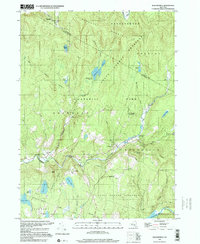
1997 Map of Willowemoc
USGS Topo · Published 2000About this map
Willowemoc and the surrounding Catskill highlands appear here in the late 1990s, defined by the winding course of Willowemoc Creek and its many tributary ponds. This area of Sullivan County is a significant hub for outdoor recreation and conservation, evidenced by the extensive State Forest Preserve and Catskill Park lands. Local history and infrastructure are marked by the State Fish Hatchery near Debruce and the Covered Bridge Campsite along the water. The landscape is dotted with isolated settlements such as Anderson and specialized sites like the Mongaup Pond Campsite. These features, alongside the northern reach of the Neversink Res, illustrate a region where protected wilderness and small mountain communities have long coexisted. Genealogists may find interest in the local Cem located near the town center, while those studying the regional geography can trace the Aqueduct and various mountain peaks like Mongaup Mountain and Slawson Mtn.
Find a feature on this map
40 named features on this map. Tap any name to fly to it.
Don’t see what you’re looking for? This feature index may not catch every label — zoom into the map to look around manually.
Map Details
Editions of this 1997 Willowemoc Map
This is the sole edition of this map. No revisions or reprints were ever made.
Other maps of this area

1901 · Margaretville
USGS Topo · 1:62,500

1904 · Margaretville
USGS Topo · 1:62,500

1910 · Neversink
USGS Topo · 1:62,500

1921 · Livingston Manor
USGS Topo · 1:62,500

1922 · Andes
USGS Topo · 1:62,500

1923 · Livingston Manor
USGS Topo · 1:62,500

1924 · Andes
USGS Topo · 1:62,500

1942 · Neversink
USGS Topo · 1:62,500

1943 · Monticello
USGS Topo · 1:125,000

1944 · Livingston Manor
USGS Topo · 1:62,500