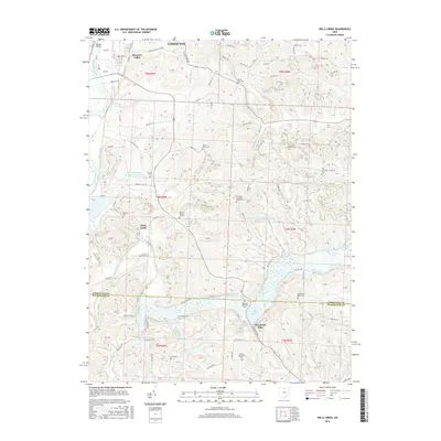
2016 Map of Wills Creek
USGS Topo · Published 2016About this map
The Muskingum River flows through the northwest corner of this region, where the Randle Bridge connects the growing outskirts of Coshocton. The landscape is defined by the winding course of Wills Creek, which feeds into the large Wills Creek Lake further south. This waterway dictates the placement of older settlements like Marquand Mills and Wills Creek, as well as numerous rural burial sites that serve as vital links to local family history.
Find a feature on this map
92 named features on this map. Tap any name to fly to it.
Don’t see what you’re looking for? This feature index may not catch every label — zoom into the map to look around manually.
Map Details
Editions of this 2016 Wills Creek Map
This is the sole edition of this map. No revisions or reprints were ever made.
Other maps of this area

1908 · Conesville
USGS Topo · 1:62,500

1909 · Cambridge
USGS Topo · 1:62,500

1910 · Conesville
USGS Topo · 1:62,500

1911 · Newcomerstown
USGS Topo · 1:62,500

1912 · Cambridge
USGS Topo · 1:62,500

1913 · Newcomerstown
USGS Topo · 1:62,500

1913 · Coshocton
USGS Topo · 1:62,500

1915 · Coshocton
USGS Topo · 1:62,500

1943 · Coshocton
USGS Topo · 1:62,500

1943 · Newcomerstown
USGS Topo · 1:62,500