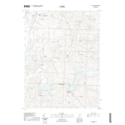
2019 Map of Wills Creek
USGS Topo · Published 2019About this map
Wills Creek and the Muskingum River converge in a landscape defined by deeply cut valleys and numerous tributary runs, including Robinson Run and Rock Run. The area near Pleasant Valley and the northern edge of the Coshocton boundary transitions from these waterways into a network of township roads and family cemeteries. This 2019 survey documents a rural topography where historic centers like Marquand Mills persist alongside spiritual landmarks such as Our Lady of Lourdes Catholic Cem and Saint Johns Lutheran Cem. The presence of the BSA-Muskingum Valley Council Lake and the crossing at Randle Bridge illustrate the modern utility of a terrain still largely shaped by its hydrography, including the Columbus and Southern Pond 0116-00.
Find a feature on this map
68 named features on this map. Tap any name to fly to it.
Don’t see what you’re looking for? This feature index may not catch every label — zoom into the map to look around manually.
Map Details
Editions of this 2019 Wills Creek Map
This is the sole edition of this map. No revisions or reprints were ever made.
Other maps of this area

1908 · Conesville
USGS Topo · 1:62,500

1909 · Cambridge
USGS Topo · 1:62,500

1910 · Conesville
USGS Topo · 1:62,500

1911 · Newcomerstown
USGS Topo · 1:62,500

1912 · Cambridge
USGS Topo · 1:62,500

1913 · Newcomerstown
USGS Topo · 1:62,500

1913 · Coshocton
USGS Topo · 1:62,500

1915 · Coshocton
USGS Topo · 1:62,500

1943 · Coshocton
USGS Topo · 1:62,500

1943 · Newcomerstown
USGS Topo · 1:62,500