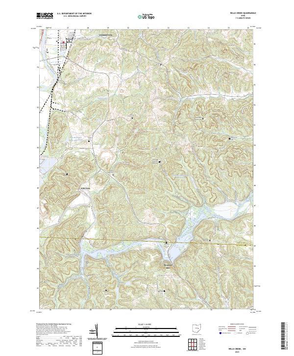
2023 Map of Wills Creek
USGS Topo · Published 2023About this map
The Muskingum River flows through the northwest corner of this landscape, where the settlement of Pleasant Valley sits just south of the Coshocton city boundary. The terrain is defined by the winding course of Wills Creek, which meanders through a wide valley floor before reaching the hamlet of Marquand Mills. This area preserves a high density of small rural burial grounds and parish sites, reflecting the long-established communities of the central Ohio hills. Genealogists will find numerous family and denominational landmarks, such as the Our Lady of Lourdes Catholic Cem, Saint Johns Lutheran Cem, and the Maysville Methodist Cem. The southern portion of the map is marked by the county line between Coshocton and Muskingum counties, cutting through a landscape of ridges and runs that includes the BSA-Muskingum Valley Council Lake and the deep incision of Cassingham Hollow.
Find a feature on this map
98 named features on this map. Tap any name to fly to it.
Don’t see what you’re looking for? This feature index may not catch every label — zoom into the map to look around manually.
Map Details
Editions of this 2023 Wills Creek Map
This is the sole edition of this map. No revisions or reprints were ever made.
Other maps of this area

1908 · Conesville
USGS Topo · 1:62,500

1909 · Cambridge
USGS Topo · 1:62,500

1910 · Conesville
USGS Topo · 1:62,500

1911 · Newcomerstown
USGS Topo · 1:62,500

1912 · Cambridge
USGS Topo · 1:62,500

1913 · Newcomerstown
USGS Topo · 1:62,500

1913 · Coshocton
USGS Topo · 1:62,500

1915 · Coshocton
USGS Topo · 1:62,500

1943 · Coshocton
USGS Topo · 1:62,500

1943 · Newcomerstown
USGS Topo · 1:62,500