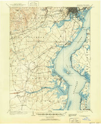
1906 Map of Wilmington
USGS Topo · Published 1951About this map
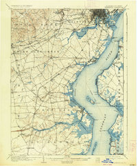
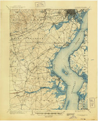
The Christina River and White Clay Creek converge in this detailed mapping of the northern Delaware corridor, dominated by the industrial and maritime hub of Wilmington. At the turn of the century, this landscape was defined by the intersection of major rail lines like the Philadelphia Wilmington and Baltimore RR and the critical water route of the Chesapeake and Delaware Canal. Defensive fortifications including Fort Delaware on Pea Patch Id and Fort Dupont stand watch over the shipping lanes of the Delaware River. Inland, the map reveals a network of small mill towns and crossroads such as Brandywine Springs, Marshallton, and Coochs Bridge. From the Alms House near Farnhurst to the marshy expanse of Cherry Island Marsh, the survey captures a region balancing heavy rail infrastructure with the tidewater geography of New Castle County.
Find a feature on this map
95 named features on this map. Tap any name to fly to it.
Don’t see what you’re looking for? This feature index may not catch every label — zoom into the map to look around manually.
Map Details
Editions of this 1906 Wilmington Map
7 editions found

Other maps of this area

1890 · Salem
USGS Topo · 1:62,500

1890 · Bay Side
USGS Topo · 1:62,500

1894 · Bay Side
USGS Topo · 1:62,500

1894 · Chester
USGS Topo · 1:62,500

1896 · Chester
USGS Topo · 1:62,500

1898 · Salem
USGS Topo · 1:62,500

1898 · Elkton
USGS Topo · 1:62,500

1898 · Chester
USGS Topo · 1:62,500

1899 · Vineland
USGS Topo · 1:125,000

1899 · Dover
USGS Topo · 1:125,000