
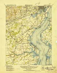
1919 Map of Wilmington
USGS Topo · Published 1919About this map
The coastal defenses and inland junctions of northern Delaware and southern New Jersey are captured here in 1919. A complex military landscape is revealed through the strategic triad of Fort Delaware on Pea Patch Id., Fort Dupont near Delaware City, and Fort Mott on the New Jersey shore. This defensive network guarded the approach to Wilmington during an era of expanding industrial and rail power.
Find a feature on this map
99 named features on this map. Tap any name to fly to it.
Don’t see what you’re looking for? This feature index may not catch every label — zoom into the map to look around manually.
Map Details
Editions of this 1919 Wilmington Map
2 editions found
Other maps of this area

1890 · Salem
USGS Topo · 1:62,500

1890 · Bay Side
USGS Topo · 1:62,500

1894 · Bay Side
USGS Topo · 1:62,500

1894 · Chester
USGS Topo · 1:62,500

1896 · Chester
USGS Topo · 1:62,500

1898 · Salem
USGS Topo · 1:62,500

1898 · Elkton
USGS Topo · 1:62,500

1898 · Chester
USGS Topo · 1:62,500

1899 · Vineland
USGS Topo · 1:125,000

1899 · Dover
USGS Topo · 1:125,000