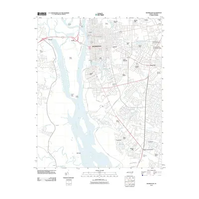
2010 Map of Wilmington
USGS Topo · Published 2010About this map
Wilmington sits at the vital confluence where the Northeast Cape Fear River joins the main Cape Fear River, creating a complex landscape of islands and tidal creeks. The eastern bank is densely developed, featuring historic landmarks like Thalian Hall and the sprawling Oakdale Cemetery. This area reflects the modern expansion of the city's suburban and academic reaches, including the University of North Carolina - Wilmington Campus Kenan Auditorium and neighborhoods such as Lincoln Forest and Delgado.
Find a feature on this map
78 named features on this map. Tap any name to fly to it.
Don’t see what you’re looking for? This feature index may not catch every label — zoom into the map to look around manually.
Map Details
Editions of this 2010 Wilmington Map
This is the sole edition of this map. No revisions or reprints were ever made.
Other maps of this area

1942 · Wilmington
USGS Topo · 1:62,500

1943 · Funston
USGS Topo · 1:24,000

1943 · Winnabow
USGS Topo · 1:24,000

1944 · Winnabow
USGS Topo · 1:31,680

1947 · Rocky Point
USGS Topo · 1:62,500

1948 · Wilmington
USGS Topo · 1:62,500

1950 · Winnabow
USGS Topo · 1:25,000

1953 · Florence
USGS Topo · 1:250,000

1953 · Beaufort
USGS Topo · 1:250,000

1954 · Florence
USGS Topo · 1:250,000