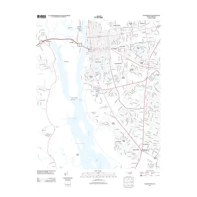
2013 Map of Wilmington
USGS Topo · Published 2013About this map
The Cape Fear River and Northeast Cape Fear River converge at the heart of this coastal landscape, defining the industrial and maritime character of the region. On the western bank, the low-lying expanse of Eagle Island sits between the main river and the Brunswick River, while the eastern shore is defined by a dense network of neighborhoods including Sunset Park, Princess Place, and Forest Hills. The map details the transition from the urban core toward the south and east, where residential developments like Echo Farms and Greenbrier meet the natural hydrology of Whiskey Cr and Hewletts Cr.
Find a feature on this map
434 named features on this map. Tap any name to fly to it.
Don’t see what you’re looking for? This feature index may not catch every label — zoom into the map to look around manually.
Map Details
Editions of this 2013 Wilmington Map
This is the sole edition of this map. No revisions or reprints were ever made.
Other maps of this area

1942 · Wilmington
USGS Topo · 1:62,500

1943 · Funston
USGS Topo · 1:24,000

1943 · Winnabow
USGS Topo · 1:24,000

1944 · Winnabow
USGS Topo · 1:31,680

1947 · Rocky Point
USGS Topo · 1:62,500

1948 · Wilmington
USGS Topo · 1:62,500

1950 · Winnabow
USGS Topo · 1:25,000

1953 · Florence
USGS Topo · 1:250,000

1953 · Beaufort
USGS Topo · 1:250,000

1954 · Florence
USGS Topo · 1:250,000