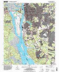
2022 Map of Wilmington
USGS Topo · Published 2022About this map
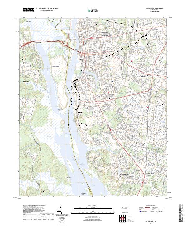
The Cape Fear River and Brunswick River define the commercial and ecological character of this coastal region, surrounding the expansive wetlands of Eagle Island. In Wilmington, the urban grid is anchored by the New Hanover County Courthouse and institutional landmarks like Cape Fear Community College. The river's significance to maritime navigation is evident in the series of charted ranges, including the Fourth East Jetty Range and Upper Brunswick Range, which guide traffic through the deep-water channels.
Find a feature on this map
54 named features on this map. Tap any name to fly to it.
Don’t see what you’re looking for? This feature index may not catch every label — zoom into the map to look around manually.
Map Details
Editions of this 2022 Wilmington Map
This is the sole edition of this map. No revisions or reprints were ever made.
Historical Maps of Fairlawn Through Time
8 maps found