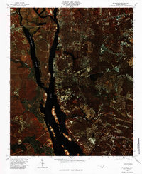
1980 Map of Wilmington
USGS Topo · Published 1985About this map
Wilmington anchors this color infrared orthophotograph, captured in 1980 by the U.S. Geological Survey. The imagery emphasizes the complex hydrologic environment where the Cape Fear River and Brunswick River converge. This coastal landscape is defined by the deep water channels of the main rivers and a dense network of smaller drainages, including Town Creek and Barnards Creek. The infrared technology provides exceptional clarity regarding the vegetation and development patterns along the riverbanks, showing the industrial and residential footprint of the city as it existed in the early 1980s.
Find a feature on this map
12 named features on this map. Tap any name to fly to it.
Don’t see what you’re looking for? This feature index may not catch every label — zoom into the map to look around manually.
Map Details
Editions of this 1980 Wilmington Map
This is the sole edition of this map. No revisions or reprints were ever made.
Other maps of this area

1942 · Wilmington
USGS Topo · 1:62,500

1943 · Funston
USGS Topo · 1:24,000

1943 · Winnabow
USGS Topo · 1:24,000

1944 · Winnabow
USGS Topo · 1:31,680

1947 · Rocky Point
USGS Topo · 1:62,500

1948 · Wilmington
USGS Topo · 1:62,500

1950 · Winnabow
USGS Topo · 1:25,000

1953 · Florence
USGS Topo · 1:250,000

1953 · Beaufort
USGS Topo · 1:250,000

1954 · Florence
USGS Topo · 1:250,000