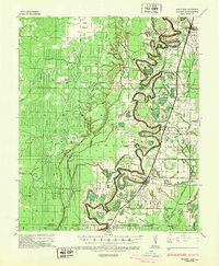
1935 Map of Wilmot
USGS Topo · Published 1947About this map
The intricate meanders of Bayou Bartholomew define this 1930s landscape along the Arkansas Louisiana border. In Ashley County, the river's serpentine path creates numerous oxbows and brakes such as Horseshoe Lake, Saunders Lake, and Bear Brake. This alluvial valley is heavily shaped by water management and transport, featuring an extensive network of drainage channels like Ditch No 1 and Ditch No 4 alongside the Missouri Pacific railroad line.
Find a feature on this map
44 named features on this map. Tap any name to fly to it.
Don’t see what you’re looking for? This feature index may not catch every label — zoom into the map to look around manually.
Map Details
Editions of this 1935 Wilmot Map
3 editions found
Other maps of this area

1935 · Mist
USGS Topo · 1:62,500

1935 · Wilmot
USGS Topo · 1:62,500

1935 · Naff
USGS Topo · 1:62,500

1935 · Oak Grove
USGS Topo · 1:62,500

1935 · Bonita
USGS Topo · 1:62,500

1936 · Eudora
USGS Topo · 1:62,500

1936 · Lake Village
USGS Topo · 1:62,500

1952 · Fountain Hill
USGS Topo · 1:24,000

1953 · Greenwood
USGS Topo · 1:250,000

1955 · Jackson
USGS Topo · 1:250,000