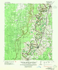
1935 Map of Wilmot
USGS Topo · Published 1954About this map
Bayou Bartholomew snakes through the center of this landscape, its complex oxbows and bends defining the border between Ashley County and Morehouse Parish. This mid-1930s survey by the War Department and Corps of Engineers documents a transition from river-dependent landings to a rail-and-road economy. While traditional water access points like Hinkle Ferry and Saunders Ldg remain, the Missouri Pacific railroad now connects the primary settlements of Wilmot, Parkdale, and Portland. The alluvial plain is heavily modified for agriculture and flood control, evidenced by several Indian Mound sites and an emerging network of drainage works including Ditch No 1 and Ditch No 5. Small rural institutions, such as Prairie Grove Ch and Farmer Sch, anchor the dispersed farming communities of Brushy Prairie and Pine Prairie along the Arkansas-Louisiana state line.
Find a feature on this map
51 named features on this map. Tap any name to fly to it.
Don’t see what you’re looking for? This feature index may not catch every label — zoom into the map to look around manually.
Map Details
Editions of this 1935 Wilmot Map
3 editions found
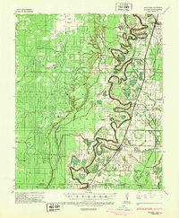
Other maps of this area

1935 · Mist
USGS Topo · 1:62,500

1935 · Wilmot
USGS Topo · 1:62,500

1935 · Naff
USGS Topo · 1:62,500

1935 · Oak Grove
USGS Topo · 1:62,500

1935 · Bonita
USGS Topo · 1:62,500

1936 · Eudora
USGS Topo · 1:62,500

1936 · Lake Village
USGS Topo · 1:62,500

1952 · Fountain Hill
USGS Topo · 1:24,000

1953 · Greenwood
USGS Topo · 1:250,000

1955 · Jackson
USGS Topo · 1:250,000