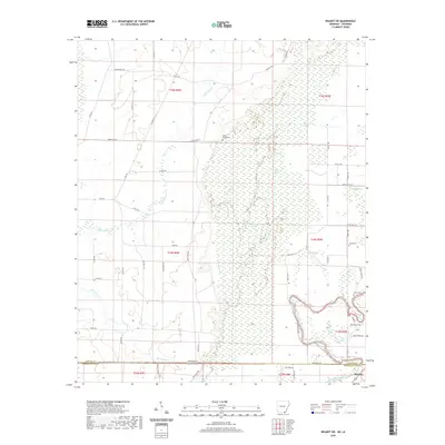
2020 Map of Wilmot SW
USGS Topo · Published 2020About this map
The Arkansas-Louisiana state line bisects this landscape, marking the transition between Ashley County and Morehouse Parish. This territory is defined by a complex drainage network where Bayou Bartholomew winds through the southern reaches near the settlement of McGinty. The central terrain is dominated by an intricate system of wetlands and backwaters, including Ox-Bone Slough, Gaines Slough, and Flat Slough, which characterize the low-lying alluvial plains. Genealogical interests are well-served by several local burial sites, such as Poley Bridge Cem in the north and Bethel Cem to the south. The road network, including State Hwy 173 and numerous parish roads like Parish Rd 9956, provides a framework for understanding the rural settlement patterns and property divisions across the t19s r5w and t23n r8e townships.
Find a feature on this map
62 named features on this map. Tap any name to fly to it.
Don’t see what you’re looking for? This feature index may not catch every label — zoom into the map to look around manually.
Map Details
Editions of this 2020 Wilmot SW Map
This is the sole edition of this map. No revisions or reprints were ever made.
Other maps of this area

1935 · Wilmot
USGS Topo · 1:62,500

1935 · Naff
USGS Topo · 1:62,500

1935 · Bonita
USGS Topo · 1:62,500

1953 · Greenwood
USGS Topo · 1:250,000

1955 · Jackson
USGS Topo · 1:250,000

1956 · Greenwood
USGS Topo · 1:250,000

1956 · Bastrop
USGS Topo · 1:62,500

1958 · Bonita
USGS Topo · 1:62,500

1960 · Wilmot
USGS Topo · 1:62,500
1960 · Portland
USGS Topo · 1:24,000