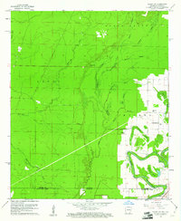
1960 Map of Wilmot SW
USGS Topo · Published 1961About this map
Bayou Bartholomew meanders across the southeast corner of this landscape, its complex oxbows and brakes defining the border between Arkansas and Louisiana. The map reveals a heavily water-logged terrain dominated by Overflow Creek and its many secondary sloughs, including Horseshoe Slough and Sawyer Slough. Settlement is concentrated along the higher ground and improved roads in the east, where rural community life is anchored by Sanctify Ch, St Matthew Ch, and Gaines Ch.
Find a feature on this map
28 named features on this map. Tap any name to fly to it.
Don’t see what you’re looking for? This feature index may not catch every label — zoom into the map to look around manually.
Map Details
Editions of this 1960 Wilmot SW Map
2 editions found
Other maps of this area

1935 · Wilmot
USGS Topo · 1:62,500

1935 · Naff
USGS Topo · 1:62,500

1935 · Bonita
USGS Topo · 1:62,500

1953 · Greenwood
USGS Topo · 1:250,000

1955 · Jackson
USGS Topo · 1:250,000

1956 · Greenwood
USGS Topo · 1:250,000

1956 · Bastrop
USGS Topo · 1:62,500

1958 · Bonita
USGS Topo · 1:62,500

1960 · Wilmot
USGS Topo · 1:62,500
1960 · Portland
USGS Topo · 1:24,000