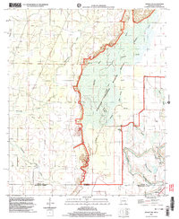
2002 Map of Wilmot SW
USGS Topo · Published 2003About this map
The Overflow National Wildlife Refuge dominates this section of the Arkansas and Louisiana borderlands, preserving a complex wetland ecosystem where Overflow Creek meets a network of slow-moving waters like Billottis Slough and Sawyer Slough. To the southeast, the meandering course of Bayou Bartholomew cuts through the terrain near the small settlement of McGinty. This survey captures the rural character of Ashley County and Morehouse Parish at the start of the 21st century, revealing a landscape defined by its hydrology and small, family-named landmarks. Genealogists and local historians can find several burial sites scattered across the higher ground bordering the wetlands, including Foley Bridge Cem, Harris Cem, and Grant Cem, alongside Gaines Ch, indicating the persistence of established local communities in this river-bottom region.
Find a feature on this map
24 named features on this map. Tap any name to fly to it.
Don’t see what you’re looking for? This feature index may not catch every label — zoom into the map to look around manually.
Map Details
Editions of this 2002 Wilmot SW Map
This is the sole edition of this map. No revisions or reprints were ever made.
Other maps of this area

1935 · Wilmot
USGS Topo · 1:62,500

1935 · Naff
USGS Topo · 1:62,500

1935 · Bonita
USGS Topo · 1:62,500

1953 · Greenwood
USGS Topo · 1:250,000

1955 · Jackson
USGS Topo · 1:250,000

1956 · Greenwood
USGS Topo · 1:250,000

1956 · Bastrop
USGS Topo · 1:62,500

1958 · Bonita
USGS Topo · 1:62,500

1960 · Wilmot
USGS Topo · 1:62,500
1960 · Portland
USGS Topo · 1:24,000