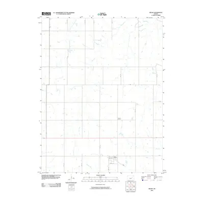
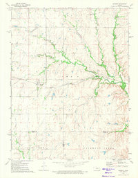
2009 Map of Wilsey
USGS Topo · Published 2009About this map
Wilsey anchors this Morris County landscape as a centralized settlement defined by a rigid grid of streets including Main St and South St. The surrounding countryside follows a classic section-line road pattern, with routes like S 2100 Rd and S 2000 Rd traversing the terrain. The hydrology is dominated by the headwaters of the Neosho River and its major tributaries, such as the West Fork Neosho River, which carve subtle paths through the prairie.
Find a feature on this map
22 named features on this map. Tap any name to fly to it.
Don’t see what you’re looking for? This feature index may not catch every label — zoom into the map to look around manually.
Map Details
Editions of this 2009 Wilsey Map
This is the sole edition of this map. No revisions or reprints were ever made.
Other maps of this area

1889 · Parkerville
USGS Topo · 1:125,000

1894 · Parkerville
USGS Topo · 1:125,000

1955 · Hutchinson
USGS Topo · 1:250,000

1959 · Hutchinson
USGS Topo · 1:250,000

1964 · Skiddy
USGS Topo · 1:24,000
1971 · Council Grove Lake
USGS Topo · 1:24,000
1971 · Dwight
USGS Topo · 1:24,000
1971 · White City
USGS Topo · 1:24,000

1972 · Wilsey
USGS Topo · 1:24,000
1972 · Burdick
USGS Topo · 1:24,000