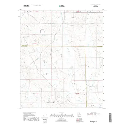
2018 Map of Wilson Creek
USGS Topo · Published 2018About this map
Oak Grove sits at the northern edge of this northern Louisiana landscape, where the headwaters of the Dugdemona River and Wilson Creek carve through a network of parish roads. The area is defined by its complex hydrology, with numerous smaller drainages like Cypress Cr, Flat Cypress Cr, and Madden Cr crisscrossing the timbered terrain. This 2018 survey reveals a landscape where parish boundaries converge, specifically the tri-point where Lincoln, Bienville, and Jackson Parishes meet along Line Rd. Local genealogy and community history are anchored by sites such as the Mount Temple Church and the adjacent Methodist Cemetery in the southern portion of the sheet, while the Pruitt Cemetery serves as a landmark further north near the banks of Wilson Creek. The distribution of family-named roads like Davis Rd, Howell Rd, and Talbert Rd suggests a long-standing pattern of rural settlement and land ownership in these piney woods.
Find a feature on this map
66 named features on this map. Tap any name to fly to it.
Don’t see what you’re looking for? This feature index may not catch every label — zoom into the map to look around manually.
Map Details
Editions of this 2018 Wilson Creek Map
This is the sole edition of this map. No revisions or reprints were ever made.
Other maps of this area

1947 · Bienville
USGS Topo · 1:62,500

1949 · Bienville
USGS Topo · 1:62,500

1950 · Ruston
USGS Topo · 1:62,500

1950 · Arcadia
USGS Topo · 1:62,500

1951 · Arcadia
USGS Topo · 1:62,500

1951 · Ruston
USGS Topo · 1:62,500

1953 · Hodge
USGS Topo · 1:62,500

1955 · Shreveport
USGS Topo · 1:250,000

1956 · Shreveport
USGS Topo · 1:250,000

1984 · Shreveport
USGS Topo · 1:250,000