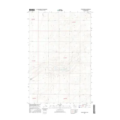
2017 Map of Wilson Creek SE
USGS Topo · Published 2017About this map
Black Rock Lake rests at the heart of this landscape, occupying a distinct depression within the larger Black Rock Coulee. This terrain is characteristic of the Channeled Scablands, where ancient glacial floods carved deep path-ways through the basalt bedrock. The map reveals a highly structured grid of section lines and gravel routes, such as Rd 19 Ne and Rd 12 Ne, which divide the surrounding plateau for agricultural use. While the coulee floor remains relatively undeveloped, the higher ground is etched with the geometric patterns of modern farming and range management. These road systems and topographic contours reflect a landscape shaped by both prehistoric geological violence and the subsequent order of the Public Land Survey System, as seen in the clear demarcation of township boundaries like t21n r30e.
Find a feature on this map
23 named features on this map. Tap any name to fly to it.
Don’t see what you’re looking for? This feature index may not catch every label — zoom into the map to look around manually.
Map Details
Editions of this 2017 Wilson Creek SE Map
This is the sole edition of this map. No revisions or reprints were ever made.
Other maps of this area

1923 · Wheeler
USGS Topo · 1:62,500

1925 · Wheeler
USGS Topo · 1:62,500

1925 · Schrag
USGS Topo · 1:62,500

1953 · Ritzville
USGS Topo · 1:250,000

1956 · Wheeler
USGS Topo · 1:24,000

1956 · Wilson Creek SW
USGS Topo · 1:24,000

1956 · Wheeler NE
USGS Topo · 1:24,000

1956 · Wilson Creek SE
USGS Topo · 1:24,000

1956 · Wilson Creek NW
USGS Topo · 1:24,000

1956 · Wilson Creek
USGS Topo · 1:62,500