
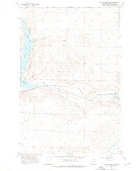
1956 Map of Wilson Creek NW
USGS Topo · Published 1957About this map
The Great Northern railroad corridor defines the southern landscape of this 1956 survey, following the path of Crab Creek as it winds toward the settlement of Wilson Creek. The map documents a complex irrigation and water management system in Grant County, highlighted by the Long Lake Dam and its associated Spillway and siphon structures. To the west, the Brook Lake State Game Reserve encompasses Long Lake and Brook Lake, preserving a significant portion of the coulee terrain for wildlife.
Find a feature on this map
16 named features on this map. Tap any name to fly to it.
Don’t see what you’re looking for? This feature index may not catch every label — zoom into the map to look around manually.
Map Details
Editions of this 1956 Wilson Creek NW Map
2 editions found
Other maps of this area

1953 · Ritzville
USGS Topo · 1:250,000

1956 · Stratford
USGS Topo · 1:24,000

1956 · Gloyd
USGS Topo · 1:24,000

1956 · Wilson Creek SW
USGS Topo · 1:24,000

1956 · Wilson Creek SE
USGS Topo · 1:24,000

1956 · Wilson Creek
USGS Topo · 1:62,500

1959 · Ritzville
USGS Topo · 1:250,000

1965 · Ritzville
USGS Topo · 1:250,000

1965 · Coulee City
USGS Topo · 1:24,000

1968 · Hartline SW
USGS Topo · 1:24,000