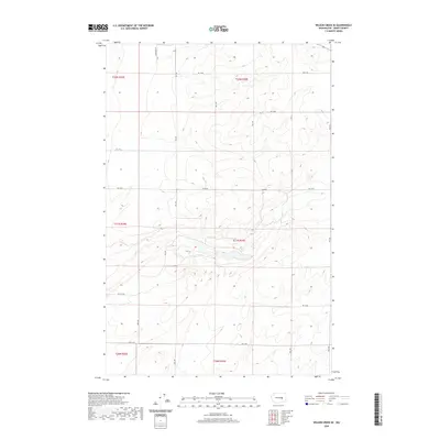
2020 Map of Wilson Creek SE
USGS Topo · Published 2020About this map
The high plateaus of Grant County are defined by a rhythmic grid of rural arteries, as seen in this 2020 landscape. A network of access points including RD 19 Ne, RD 18 Ne, and RD 17 Ne serves the extensive agricultural sections across the high desert terrain. This quadrangle provides a clear look at the Public Land Survey System (PLSS) organization of central Washington, explicitly marking the township and range boundaries for t22n r29e, t22n r30e, and t21n r30e. While few structures or named settlements appear in this specific quadrant, the meticulous recording of road numbers such as RD 16 Ne and RD 12 Ne allows researchers to pin down specific land holdings and agricultural properties within the sprawling Grant County interior.
Find a feature on this map
14 named features on this map. Tap any name to fly to it.
Don’t see what you’re looking for? This feature index may not catch every label — zoom into the map to look around manually.
Map Details
Editions of this 2020 Wilson Creek SE Map
This is the sole edition of this map. No revisions or reprints were ever made.
Other maps of this area

1923 · Wheeler
USGS Topo · 1:62,500

1925 · Wheeler
USGS Topo · 1:62,500

1925 · Schrag
USGS Topo · 1:62,500

1953 · Ritzville
USGS Topo · 1:250,000

1956 · Wheeler
USGS Topo · 1:24,000

1956 · Wilson Creek SW
USGS Topo · 1:24,000

1956 · Wheeler NE
USGS Topo · 1:24,000

1956 · Wilson Creek SE
USGS Topo · 1:24,000

1956 · Wilson Creek NW
USGS Topo · 1:24,000

1956 · Wilson Creek
USGS Topo · 1:62,500