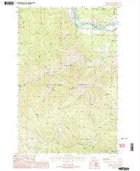
1988 Map of Wilson Gulch
USGS Topo · Published 1988About this map
The Clark Fork cuts through the northern reaches of the Lolo National Forest, serving as a primary corridor for both natural drainage and human transit. By the late 1980s, the landscape here remained largely defined by its steep drainage systems, including Wilson Gulch and Thompson Creek, which flow toward the river. Resource extraction and recreation are evident throughout the terrain, marked by the presence of tailings and several prospect sites alongside the Slowey Campground near the riverbanks. High-altitude landmarks like Sheep Mountain and Mount Baldy dominate the southern topography, while Wilson Lake provides a rare alpine water body at the head of its namesake gulch. An Old RR Grade following the river reflects the historical rail infrastructure that once moved timber and minerals through this part of Mineral County.
Find a feature on this map
30 named features on this map. Tap any name to fly to it.
Don’t see what you’re looking for? This feature index may not catch every label — zoom into the map to look around manually.
Map Details
Editions of this 1988 Wilson Gulch Map
2 editions found
Other maps of this area

1918 · St Regis
USGS Topo · 1:125,000

1919 · St. Regis
USGS Topo · 1:125,000

1956 · St Regis
USGS Topo · 1:62,500

1956 · Wallace
USGS Topo · 1:250,000

1957 · Illinois Peak
USGS Topo · 1:62,500

1959 · Plains
USGS Topo · 1:62,500

1960 · Wallace
USGS Topo · 1:250,000

1960 · Superior
USGS Topo · 1:62,500
1985 · Superior
USGS Topo · 1:24,000
1985 · Keystone Peak
USGS Topo · 1:24,000