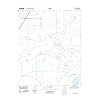
2011 Map of Wilson
USGS Topo · Published 2011About this map
Wilson sits at the heart of this Mississippi River landscape, defined by a grid of agricultural roads and the protective curves of the Levee Rd. The map illustrates a region managed by water engineering, featuring the Golden Lake Revetment and the Bend of island 35 Revetment along the Mississippi River. Several small settlements like Marie, Driver, and Evadale are connected by a network of county roads, while local history is preserved in scattered burial grounds including Macedonia Cemetery and Pittman Cemetery. The area's relationship with the river is further detailed by features such as Golden Lake Crevasse and Howards Landing. Aviation also plays a role in this rural landscape, with both Lowrance Airport and the Wilson Landing Strip serving the local community.
Find a feature on this map
58 named features on this map. Tap any name to fly to it.
Don’t see what you’re looking for? This feature index may not catch every label — zoom into the map to look around manually.
Map Details
Editions of this 2011 Wilson Map
This is the sole edition of this map. No revisions or reprints were ever made.
Other maps of this area

1931 · Jericho
USGS Topo · 1:62,500

1939 · Jericho
USGS Topo · 1:62,500

1939 · Evadale
USGS Topo · 1:62,500

1942 · Millington
USGS Topo · 1:62,500

1952 · Jericho
USGS Topo · 1:62,500

1953 · Memphis
USGS Topo · 1:250,000

1956 · Evadale
USGS Topo · 1:62,500

1956 · Memphis
USGS Topo · 1:250,000

1956 · Blytheville
USGS Topo · 1:250,000

1959 · Blytheville
USGS Topo · 1:250,000