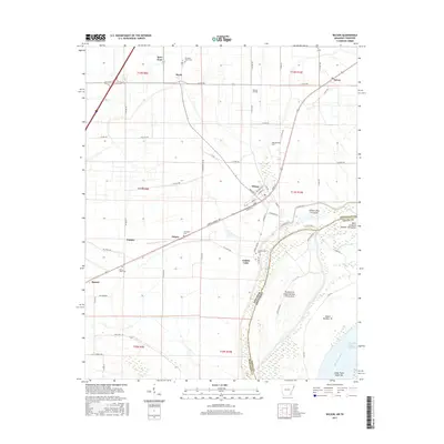
2017 Map of Wilson
USGS Topo · Published 2017About this map
The Mississippi River creates a dynamic border along the eastern edge of this quadrangle, shaping the fertile agricultural lands of Mississippi Co. The town of Wilson stands as a primary hub, showing a grid of streets including Main St and Madison St that anchor the local community. The landscape is dotted with several smaller settlements such as Marie, Driver, and Evadale, which are interconnected by a network of county roads like Co RD 892 and Cortez Kennedy Ave.
Find a feature on this map
73 named features on this map. Tap any name to fly to it.
Don’t see what you’re looking for? This feature index may not catch every label — zoom into the map to look around manually.
Map Details
Editions of this 2017 Wilson Map
This is the sole edition of this map. No revisions or reprints were ever made.
Other maps of this area

1931 · Jericho
USGS Topo · 1:62,500

1939 · Jericho
USGS Topo · 1:62,500

1939 · Evadale
USGS Topo · 1:62,500

1942 · Millington
USGS Topo · 1:62,500

1952 · Jericho
USGS Topo · 1:62,500

1953 · Memphis
USGS Topo · 1:250,000

1956 · Evadale
USGS Topo · 1:62,500

1956 · Memphis
USGS Topo · 1:250,000

1956 · Blytheville
USGS Topo · 1:250,000

1959 · Blytheville
USGS Topo · 1:250,000