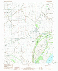
1983 Map of Wilson
USGS Topo · Published 1983About this map
The Mississippi River defines the southeastern edge of this delta landscape, where the boundary between Arkansas and Tennessee shifts across Island No 35 and Towhead Island. In the early 1980s, the agricultural economy of Mississippi County was heavily managed by an intricate network of drainage systems, including Ditch No 9 and Ditch No 32, which supported the surrounding fields. The town of Wilson serves as a central hub, flanked by the Burlington Northern railroad and the Delta Valley & Southern line. Smaller communities like Marie, Driver, and Evadale are scattered throughout the region, often centered around local landmarks such as Rivercrest High Sch or New Mt Zion Ch. For genealogists, the map preserves the locations of rural burial grounds like Pleasant Grove Cem and Pittman Cem, providing a clear view of the area's social and industrial infrastructure before modern expansion.
Find a feature on this map
46 named features on this map. Tap any name to fly to it.
Don’t see what you’re looking for? This feature index may not catch every label — zoom into the map to look around manually.
Map Details
Editions of this 1983 Wilson Map
This is the sole edition of this map. No revisions or reprints were ever made.
Other maps of this area

1931 · Jericho
USGS Topo · 1:62,500

1939 · Jericho
USGS Topo · 1:62,500

1939 · Evadale
USGS Topo · 1:62,500

1942 · Millington
USGS Topo · 1:62,500

1952 · Jericho
USGS Topo · 1:62,500

1953 · Memphis
USGS Topo · 1:250,000

1956 · Evadale
USGS Topo · 1:62,500

1956 · Memphis
USGS Topo · 1:250,000

1956 · Blytheville
USGS Topo · 1:250,000

1959 · Blytheville
USGS Topo · 1:250,000