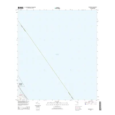
2015 Map of Wilson OE E
USGS Topo · Published 2015About this map
The Atlantic Ocean dominates this coastal survey, where the terrestrial landscape of Brevard County meets the shoreline. A narrow strip of the Canaveral National Seashore is visible along the southwestern edge, illustrating the protected coastal barrier system. This maritime environment is defined by its lack of dense development, with the primary infrastructure consisting of Samuel C Phillips Pky and Perimeter Rd, which provide access through the coastal terrain. The map's focus is on the jurisdictional boundary of Brevard County as it extends into the sea, highlighting the intersection of federal conservation land and open water in the mid-2010s.
Find a feature on this map
7 named features on this map. Tap any name to fly to it.
Don’t see what you’re looking for? This feature index may not catch every label — zoom into the map to look around manually.
Map Details
Editions of this 2015 Wilson OE E Map
This is the sole edition of this map. No revisions or reprints were ever made.
Other maps of this area

1949 · Pardon Island
USGS Topo · 1:24,000

1949 · Orsino
USGS Topo · 1:24,000

1949 · False Cape
USGS Topo · 1:24,000

1949 · Wilson
USGS Topo · 1:24,000

1951 · False Cape
USGS Topo · 1:24,000

1951 · Orsino
USGS Topo · 1:24,000

1952 · Wilson
USGS Topo · 1:24,000
1952 · Pardon Island
USGS Topo · 1:24,000

1955 · Orlando
USGS Topo · 1:250,000

1957 · Orlando
USGS Topo · 1:250,000