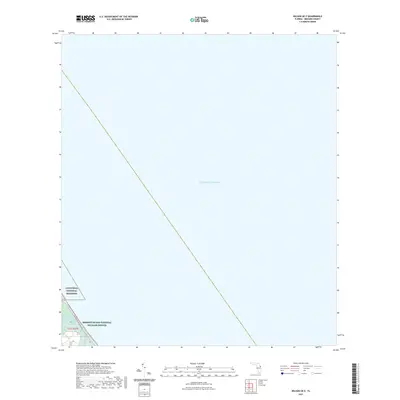
2021 Map of Wilson OE E
USGS Topo · Published 2021About this map
The Atlantic Ocean dominates this coastal survey, where the barrier island landscape of Brevard County meets the sea. Along the western edge of the sheet, the protected boundaries of the Canaveral National Seashore and Merritt Island National Wildlife Refuge preserve a critical ecological buffer of marsh and dunes. These conservation lands are bisected by the Max Brewer Memorial Pkwy, a vital transportation artery connecting the mainland to these preserved coastal reaches. Small water features like Bald Pate Creek highlight the intricate hydrography where salt and brackish water systems interface. This recent digital rendering illustrates the tension between accessibility and conservation on Florida's Space Coast, documenting the fixed boundaries of federal lands against the shifting shoreline of the Atlantic.
Find a feature on this map
6 named features on this map. Tap any name to fly to it.
Don’t see what you’re looking for? This feature index may not catch every label — zoom into the map to look around manually.
Map Details
Editions of this 2021 Wilson OE E Map
This is the sole edition of this map. No revisions or reprints were ever made.
Other maps of this area

1949 · Pardon Island
USGS Topo · 1:24,000

1949 · Orsino
USGS Topo · 1:24,000

1949 · False Cape
USGS Topo · 1:24,000

1949 · Wilson
USGS Topo · 1:24,000

1951 · False Cape
USGS Topo · 1:24,000

1951 · Orsino
USGS Topo · 1:24,000

1952 · Wilson
USGS Topo · 1:24,000
1952 · Pardon Island
USGS Topo · 1:24,000

1955 · Orlando
USGS Topo · 1:250,000

1957 · Orlando
USGS Topo · 1:250,000