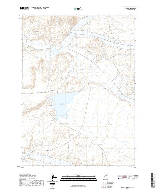
2021 Map of Wilson Reservoir
USGS Topo · Published 2021About this map
Wilson Reservoir occupies a central position in this high-desert Elko County landscape, serving as a primary water source in a region defined by its drainages and canyons. The reservoir is fed and drained by a network of waterways including Wilson Cr and Deep Cr, which cut through the varied topography of the area. To the north, the Silver Creek Valley provides a wide drainage for Silver Cr and Indian Cr, while the terrain to the east is marked by the distinct geological formation of Wilson Creek Canyon. This 2021 survey by the U.S. Geological Survey illustrates the complex Public Land Survey System (PLSS) grid, documenting townships T43N through T45N across ranges R50E and R51E. The map detail highlights the relationship between the seasonal water system and the vast grazing or conservation lands typical of northeastern Nevada.
Find a feature on this map
13 named features on this map. Tap any name to fly to it.
Don’t see what you’re looking for? This feature index may not catch every label — zoom into the map to look around manually.
Map Details
Editions of this 2021 Wilson Reservoir Map
This is the sole edition of this map. No revisions or reprints were ever made.
Other maps of this area

1939 · Owyhee
USGS Topo · 1:62,500

1942 · Owyhee
USGS Topo · 1:62,500

1955 · McDermitt
USGS Topo · 1:250,000

1956 · Bull Run
USGS Topo · 1:62,500

1959 · McDermitt
USGS Topo · 1:250,000

1964 · Hat Peak
USGS Topo · 1:62,500

1964 · Wilson Reservoir
USGS Topo · 1:62,500
1971 · Dry Creek Reservoir
USGS Topo · 1:24,000

1982 · Bull Run Mts
USGS Topo · 1:100,000
1987 · Fourmile Butte
USGS Topo · 1:24,000