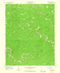
1963 Map of Wilsondale
USGS Topo · Published 1964About this map
Cabwaylingo State Forest dominates the western portion of this rugged landscape in Wayne and Mingo Counties during the early 1960s. The map captures a high concentration of extraction activity, with numerous Gas Wells and Oil Wells scattered across the ridges and hollows, often accessible only by a primitive Jeep Trail. The Norfolk and Western railroad follows the winding path of Twelvepole Creek, serving as a vital transportation artery for the small communities of Wilsondale, Lowney, and Spaulding. Local life is anchored by family-named landmarks and rural institutions, including the Jennie Creek Ch and several small schools like the Lower Turkey Cr Sch. Numerous family burial grounds, such as the Matty Ferguson Cem and Meade and Messer Cem, provide a detailed record for genealogists researching the residents of this pocket of the Appalachian coalfields.
Find a feature on this map
91 named features on this map. Tap any name to fly to it.
Don’t see what you’re looking for? This feature index may not catch every label — zoom into the map to look around manually.
Map Details
Editions of this 1963 Wilsondale Map
3 editions found
Other maps of this area

1887 · Warfield
USGS Topo · 1:125,000

1891 · Warfield
USGS Topo · 1:125,000

1892 · Huntington
USGS Topo · 1:125,000

1898 · Huntington
USGS Topo · 1:125,000

1902 · Midkiff
USGS Topo · 1:62,500

1907 · Midkiff
USGS Topo · 1:62,500

1909 · Wayne
USGS Topo · 1:62,500

1909 · Midkiff
USGS Topo · 1:62,500

1910 · Holden
USGS Topo · 1:48,000

1910 · Naugatuck
USGS Topo · 1:48,000