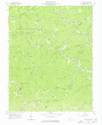
1963 Map of Wilsondale
USGS Topo · Published 1977About this map
Cabwaylingo State Forest dominates this section of the West Virginia coalfields, characterized by a dense network of gas wells and winding hollows. The landscape is defined by the convergence of Twelvepole Creek and numerous branches like Jennie Branch and Honey Branch, which carved deep valleys into Perry Ridge and Tick Ridge. Small settlements such as Wilsondale and Breeden serve as focal points for the rural community, while family-named landmarks and cemeteries like Matty Ferguson Cem and Meader and Messer Cem provide deep genealogical connections to the land.
Find a feature on this map
84 named features on this map. Tap any name to fly to it.
Don’t see what you’re looking for? This feature index may not catch every label — zoom into the map to look around manually.
Map Details
Editions of this 1963 Wilsondale Map
3 editions found
Other maps of this area

1887 · Warfield
USGS Topo · 1:125,000

1891 · Warfield
USGS Topo · 1:125,000

1892 · Huntington
USGS Topo · 1:125,000

1898 · Huntington
USGS Topo · 1:125,000

1902 · Midkiff
USGS Topo · 1:62,500

1907 · Midkiff
USGS Topo · 1:62,500

1909 · Wayne
USGS Topo · 1:62,500

1909 · Midkiff
USGS Topo · 1:62,500

1910 · Holden
USGS Topo · 1:48,000

1910 · Naugatuck
USGS Topo · 1:48,000