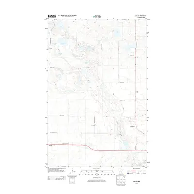
2013 Map of Wilton
USGS Topo · Published 2013About this map
Wilton and Solway anchor this 2013 landscape in Beltrami County, where the transition from agricultural tracts to lake-dotted woodlands is clearly defined. The southern corridor is dominated by the path of Us-2, connecting the local post office at Wilton with the settlement of Solway. Scattered throughout the townships are several notable burial grounds, including Sacred Heart Catholic Cem and Lammers Cem, which offer significant data points for genealogical research.
Find a feature on this map
44 named features on this map. Tap any name to fly to it.
Don’t see what you’re looking for? This feature index may not catch every label — zoom into the map to look around manually.
Map Details
Editions of this 2013 Wilton Map
This is the sole edition of this map. No revisions or reprints were ever made.
Other maps of this area

1919 · Solway
USGS Topo · 1:62,500

1920 · Buena Vista
USGS Topo · 1:62,500

1943 · Solway
USGS Topo · 1:62,500

1954 · Bemidji
USGS Topo · 1:250,000

1957 · Bemidji
USGS Topo · 1:250,000

1958 · Bemidji
USGS Topo · 1:250,000

1968 · Bemidji West
USGS Topo · 1:24,000

1972 · Alida
USGS Topo · 1:24,000

1972 · Peterson Lake
USGS Topo · 1:24,000
1972 · Debs
USGS Topo · 1:24,000