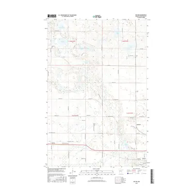
2016 Map of Wilton
USGS Topo · Published 2016About this map
Wilton and the neighboring community of Solway anchor the southern portion of this landscape in Beltrami County, marking a region defined by glacial lakes and a complex network of rural roads. The terrain is densely pocketed with water bodies such as Whitefish Lake, Funkley Lake, and Wolf Lake, while Grant Creek meanders through the central sections toward Grant Lake. The survey reveals a significant number of small cemeteries, including Sacred Heart Catholic Cem and Lammers Cem, which often represent the last visible landmarks of early pioneer families and smaller settlements like Scribner. The road system, characterized by names like Caribou Footed Dr NW and Beaver Lodge Ln NW, reflects the area's ongoing connection to its wilderness character and local fauna.
Find a feature on this map
65 named features on this map. Tap any name to fly to it.
Don’t see what you’re looking for? This feature index may not catch every label — zoom into the map to look around manually.
Map Details
Editions of this 2016 Wilton Map
This is the sole edition of this map. No revisions or reprints were ever made.
Other maps of this area

1919 · Solway
USGS Topo · 1:62,500

1920 · Buena Vista
USGS Topo · 1:62,500

1943 · Solway
USGS Topo · 1:62,500

1954 · Bemidji
USGS Topo · 1:250,000

1957 · Bemidji
USGS Topo · 1:250,000

1958 · Bemidji
USGS Topo · 1:250,000

1968 · Bemidji West
USGS Topo · 1:24,000

1972 · Alida
USGS Topo · 1:24,000

1972 · Peterson Lake
USGS Topo · 1:24,000
1972 · Debs
USGS Topo · 1:24,000