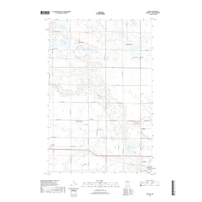
2019 Map of Wilton
USGS Topo · Published 2019About this map
The low-lying wetlands of western Beltrami County are defined by a complex network of glacial lakes and slow-moving water in this 2019 survey. The terrain is dominated by water bodies such as Little Buzzle Lake, Wolf Lake, and Whitefish Lake, which feed into the meandering course of Grant Creek. Small settlements are concentrated along the primary east-west transport corridor, notably the communities of Wilton, Solway, and Scribner.
Find a feature on this map
64 named features on this map. Tap any name to fly to it.
Don’t see what you’re looking for? This feature index may not catch every label — zoom into the map to look around manually.
Map Details
Editions of this 2019 Wilton Map
This is the sole edition of this map. No revisions or reprints were ever made.
Other maps of this area

1919 · Solway
USGS Topo · 1:62,500

1920 · Buena Vista
USGS Topo · 1:62,500

1943 · Solway
USGS Topo · 1:62,500

1954 · Bemidji
USGS Topo · 1:250,000

1957 · Bemidji
USGS Topo · 1:250,000

1958 · Bemidji
USGS Topo · 1:250,000

1968 · Bemidji West
USGS Topo · 1:24,000

1972 · Alida
USGS Topo · 1:24,000

1972 · Peterson Lake
USGS Topo · 1:24,000
1972 · Debs
USGS Topo · 1:24,000