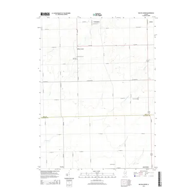
2015 Map of Wilton Center
USGS Topo · Published 2015About this map
Wilton Center serves as a focal point for this rural landscape where Will and Kankakee counties meet. The area is defined by its agricultural layout, with a grid of country roads such as W Joliet Rd and S Cedar Rd connecting long-standing local landmarks. Genealogists will find significant detail in the placement of historic burial grounds, including the Wilton Center Cem, Mount Saint Patrick Cem, and the West Peotone Presbyterian Cem further east. The terrain is subtly shaped by the winding paths of Forked Cr and the S Br Forked Cr, which eventually give way to Rock Cr in the southern portion of the quadrangle near Manteno. Small settlements like Wallingford, Andres, and Deselm remain visible as small clusters along the rail-straight county line roads, illustrating the persistent 19th-century settlement patterns of the Illinois prairie.
Find a feature on this map
43 named features on this map. Tap any name to fly to it.
Don’t see what you’re looking for? This feature index may not catch every label — zoom into the map to look around manually.
Map Details
Editions of this 2015 Wilton Center Map
This is the sole edition of this map. No revisions or reprints were ever made.
Other maps of this area

1892 · Wilmington
USGS Topo · 1:62,500

1918 · Wilmington
USGS Topo · 1:62,500

1922 · Kankakee
USGS Topo · 1:62,500

1923 · Herscher
USGS Topo · 1:62,500

1924 · Kankakee
USGS Topo · 1:62,500

1925 · Herscher
USGS Topo · 1:62,500

1929 · Brisbane
USGS Topo · 1:24,000

1930 · Frankfort
USGS Topo · 1:24,000

1949 · Peotone
USGS Topo · 1:62,500

1953 · Peotone
USGS Topo · 1:24,000