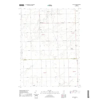
2018 Map of Wilton Center
USGS Topo · Published 2018About this map
Wilton Center and the surrounding prairie land on the border of Will and Kankakee Counties are defined by a strictly surveyed grid of agricultural roads and scattered rural settlements. The landscape is drained by the winding courses of Forked Cr and Rock Cr, which break the geometric precision of the township and range lines. Small communities like Andres in the northeast and Deselm in the southwest serve as local anchors for this farming region. Genealogists will find several significant burial sites documented, including the Wilton Center Cem, Mount Saint Patrick Cem, and the West Peotone Presbyterian Cem. The presence of the Neiner Airport near the southern boundary reflects the modern integration of aviation into this traditional Illinois agricultural corridor, while the network of county roads like Co Hwy 7 and Co Hwy 9 continues to facilitate the movement of goods through the heart of the Midwest.
Find a feature on this map
43 named features on this map. Tap any name to fly to it.
Don’t see what you’re looking for? This feature index may not catch every label — zoom into the map to look around manually.
Map Details
Editions of this 2018 Wilton Center Map
This is the sole edition of this map. No revisions or reprints were ever made.
Other maps of this area

1892 · Wilmington
USGS Topo · 1:62,500

1918 · Wilmington
USGS Topo · 1:62,500

1922 · Kankakee
USGS Topo · 1:62,500

1923 · Herscher
USGS Topo · 1:62,500

1924 · Kankakee
USGS Topo · 1:62,500

1925 · Herscher
USGS Topo · 1:62,500

1929 · Brisbane
USGS Topo · 1:24,000

1930 · Frankfort
USGS Topo · 1:24,000

1949 · Peotone
USGS Topo · 1:62,500

1953 · Peotone
USGS Topo · 1:24,000