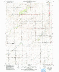
1990 Map of Wilton Center
USGS Topo · Published 1991About this map
Wilton Center serves as a focal point for this agrarian landscape on the border of Will and Kankakee Counties. This 1990 field-checked survey illustrates a region defined by its drainage and early transport networks, notably where Forked Creek and the South Branch Forked Creek wind through the township. The presence of several private airfields, such as the Viall Homestead Landing Strip and Moran Landing Strip, suggests a landscape of large homesteads and modern agricultural management.
Find a feature on this map
33 named features on this map. Tap any name to fly to it.
Don’t see what you’re looking for? This feature index may not catch every label — zoom into the map to look around manually.
Map Details
Editions of this 1990 Wilton Center Map
This is the sole edition of this map. No revisions or reprints were ever made.
Other maps of this area

1892 · Wilmington
USGS Topo · 1:62,500

1918 · Wilmington
USGS Topo · 1:62,500

1922 · Kankakee
USGS Topo · 1:62,500

1923 · Herscher
USGS Topo · 1:62,500

1924 · Kankakee
USGS Topo · 1:62,500

1925 · Herscher
USGS Topo · 1:62,500

1929 · Brisbane
USGS Topo · 1:24,000

1930 · Frankfort
USGS Topo · 1:24,000

1949 · Peotone
USGS Topo · 1:62,500

1953 · Peotone
USGS Topo · 1:24,000