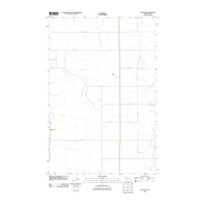
2011 Map of Wilton SE
USGS Topo · Published 2011About this map
Wogansport anchors the western edge of this prairie landscape, situated near a network of section-line roads that define the rural character of Burleigh County. The drainage of Burnt Creek meanders through the eastern and central portions of the quadrangle, illustrating the natural watercourses that shaped early settlement patterns and agricultural development in this part of North Dakota. Evidence of the area's long-term community history is preserved at Rosehill Cemetery, located centrally along the north-south transit corridor. The map reflects a classic Great Plains grid, where established routes like 240th Ave NW and 15th St NW provide access to the vast agricultural tracts between the scattered local landmarks.
Find a feature on this map
15 named features on this map. Tap any name to fly to it.
Don’t see what you’re looking for? This feature index may not catch every label — zoom into the map to look around manually.
Map Details
Editions of this 2011 Wilton SE Map
This is the sole edition of this map. No revisions or reprints were ever made.
Other maps of this area

1907 · Bismarck
USGS Topo · 1:125,000

1950 · Wilton
USGS Topo · 1:62,500

1951 · Bismarck
USGS Topo · 1:62,500

1951 · Menoken
USGS Topo · 1:62,500

1954 · Bismarck
USGS Topo · 1:250,000

1954 · McClusky
USGS Topo · 1:250,000

1958 · Bismarck
USGS Topo · 1:250,000

1958 · McClusky
USGS Topo · 1:250,000

1962 · Harmon
USGS Topo · 1:24,000
1962 · Burnt Butte
USGS Topo · 1:24,000