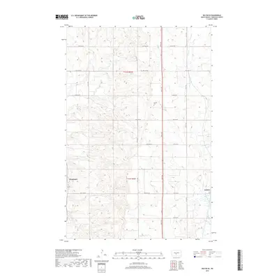
2018 Map of Wilton SE
USGS Topo · Published 2018About this map
Wogansport and Baldwin define the eastern Burleigh County landscape in this 2018 survey, reflecting the persistent rural structure of the North Dakota prairie. The terrain is characterized by the meandering path of Burnt Creek, which drains toward the southwest, and a strictly organized section-line road network including 201st Ave NW and 3rd St NW. This layout underscores the enduring legacy of the Public Land Survey System, specifically within t141n r80w and t142n r80w. Local history is anchored by the Rosehill Cem, situated centrally among the rolling hills and agricultural allotments. The map captures the quiet transition of a traditional farming region as it maintains its historic settlement patterns into the twenty-first century, providing a clear record of the area's geography before further modern development.
Find a feature on this map
24 named features on this map. Tap any name to fly to it.
Don’t see what you’re looking for? This feature index may not catch every label — zoom into the map to look around manually.
Map Details
Editions of this 2018 Wilton SE Map
This is the sole edition of this map. No revisions or reprints were ever made.
Other maps of this area

1907 · Bismarck
USGS Topo · 1:125,000

1950 · Wilton
USGS Topo · 1:62,500

1951 · Bismarck
USGS Topo · 1:62,500

1951 · Menoken
USGS Topo · 1:62,500

1954 · Bismarck
USGS Topo · 1:250,000

1954 · McClusky
USGS Topo · 1:250,000

1958 · Bismarck
USGS Topo · 1:250,000

1958 · McClusky
USGS Topo · 1:250,000

1962 · Harmon
USGS Topo · 1:24,000
1962 · Burnt Butte
USGS Topo · 1:24,000