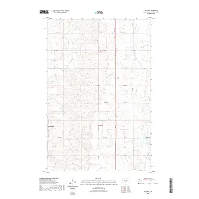
2020 Map of Wilton SE
USGS Topo · Published 2020About this map
Wogansport and Baldwin anchor the southern half of this Burleigh County landscape, representing small community hubs in an area defined by a rigorous sectional road grid. The terrain is notably dissected by the meandering course of Burnt Cr, which cuts through the undulating topography of the Missouri Plateau. A significant landmark for local history and genealogy is Rosehill Cem, situated near the center of the survey area. The map illustrates a contemporary rural North Dakota environment where a dense network of local roads, such as 279th Ave NW and 3rd St NW, provides access to individual farmsteads and agricultural tracts, maintaining a settlement pattern that has persisted for generations.
Find a feature on this map
23 named features on this map. Tap any name to fly to it.
Don’t see what you’re looking for? This feature index may not catch every label — zoom into the map to look around manually.
Map Details
Editions of this 2020 Wilton SE Map
This is the sole edition of this map. No revisions or reprints were ever made.
Other maps of this area

1907 · Bismarck
USGS Topo · 1:125,000

1950 · Wilton
USGS Topo · 1:62,500

1951 · Bismarck
USGS Topo · 1:62,500

1951 · Menoken
USGS Topo · 1:62,500

1954 · Bismarck
USGS Topo · 1:250,000

1954 · McClusky
USGS Topo · 1:250,000

1958 · Bismarck
USGS Topo · 1:250,000

1958 · McClusky
USGS Topo · 1:250,000

1962 · Harmon
USGS Topo · 1:24,000
1962 · Burnt Butte
USGS Topo · 1:24,000